
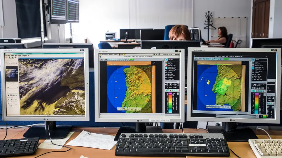
The IPMA clarified that the degravation of depression Charles was not anticipated until 6 p.m. on Tuesday, after declaring the alert situation for Wednesday.
© Global Images
12/11/2026
by
Lusa
O Portuguese Institute of the Sea and Atmosphere (IPMA) today highlighted the “uncertainty” of depression Charles and clarified that only by 18:00 on Tuesday, already after declared alert situation for Wednesday, it was that it was anticipated a degravation.
“ The models tended to move the trajectory further south and decreased the probability of the most severe scenarios, although not completely excluded”, according to weather information received at 18:00 on Tuesday regarding the evolution of depression Charles, based on data collected at 12:00, today indicated the IPMA.
In a statement, the institute stated that it noted these changes to the National Emergency and Civil Protection Authority (ANEPC), waiting for confirmation of the Wednesday 00:00 data on numerical weather forecast models, received from 06:00, to make decisions regarding weather warnings.
“ Taking into account the slowdown evidenced by the vast majority of the scenarios of ECMWF ensemble and the AROME model, IPMA began to lower the level of wind warnings in several districts”, from the morning of Wednesday, pointed out, referring that the accumulated values of precipitation predicted “were always quite high”, so the decrease in the intensity of depression did not result in a fall in the precipitation parameter, and it was decided to keep red warning (the most serious) in some districts of mainland Portugal.
Before, on Tuesday, weather forecasts pointed to bursts that could reach 160 kilometers per hour (km/h) in the Greater Lisbon area and, in view of this data, about 24 hours from the arrival of depression Charles to the continent, the IPMA decided to issue “red wind warning to the districts of the region south of the district of Leiria, taking into account the uncertainty in the trajectory”.
It was on Tuesday morning that the government announced the alert situation and the measures taken against the passage of depression Charles.
According to IPMA, the monitoring of this weather situation began on Sunday, when it was evidenced “the displacement of a depression centered south-east of Bermuda towards the Madeira archipelago, with high uncertainty in the trajectory from that moment and a set of possibilities between Morocco and northern mainland Portugal”.
On Monday, depression Charles was named by IPMA “due to the expected impact on the Madeira archipelago and later on the continent”, with the different solutions of numerical weather forecasting models pointing to “several extreme scenarios showing a deep depression dig, with pressure values between 956 and 975 hPa [hectopascal]”.
In view of this forecast, “the first orange warning (the second most serious of a three-scale) wind to the south of the district of Leiria was issued, choosing to wait for a further update of the models before issuing higher level warnings,” the IPMA indicated, explaining that, at that time, the passage of depression across the continent was about 36 hours away.
Tuesday's 00:00 forecast confirmed Monday's 12:00 forecast, with most of the scenarios showing "a better defined trajectory, yet varying between Cabo de Sines and Cabo Carvoeiro".
Throughout the day of Wednesday, already with the country in a state of alert, depression began to be monitored through satellite images, when it was still moving to the Madeira archipelago, with the movement appearing to move further south, the institute reported, explaining that there was “a significant change in the trajectory and intensity of depression from the moment it passed to the north of Madeira, very unusual at such a short time distance”.
“ The passage further south than predicted modified the atmospheric environment that depression Charles would encounter, moving it away from the region where the jet stream was located, whose interaction would be the engine of a possible more intense cyclogenesis, as it was predicted by several scenarios until then,” he said, adding that a separation was also identified in two distinct nuclei, which would distribute the energy by both, “resulting in a weakening of the system in the face of the initially predicted, before the arrival on the continent”.
According to IPMA, depression caused lower bursts than initially predicted, yet compatible with yellow warning (the least severe), of the order of 70 to 90 km/h on the southern coast and, in some more exposed points, according to the stations of Cabo da Roca, Foia and Loulé (Cavalos do Caldeirão), values were reached compatible with orange warning, and the maximum burst was 123 km/h, in Fóia, Algarve.
As for the precipitation values, the institute considered that they justified the red warning by accumulation in six hours (> 60 mm (mm)) in several stations of the Lisbon district, where 60 to 80 mm were registered, while in all districts of the South region, as well as in Santarém and Castelo Branco, precipitation values were reached compatible with orange warning, between 40 and 60 mm in six hours.
The depression Charles, which initially passed through the archipelago of Madeira before entering mainland Portugal, moved towards Spain at the end of Wednesday afternoon, after causing more than 1,600 occurrences, especially floods, but without fatalities.